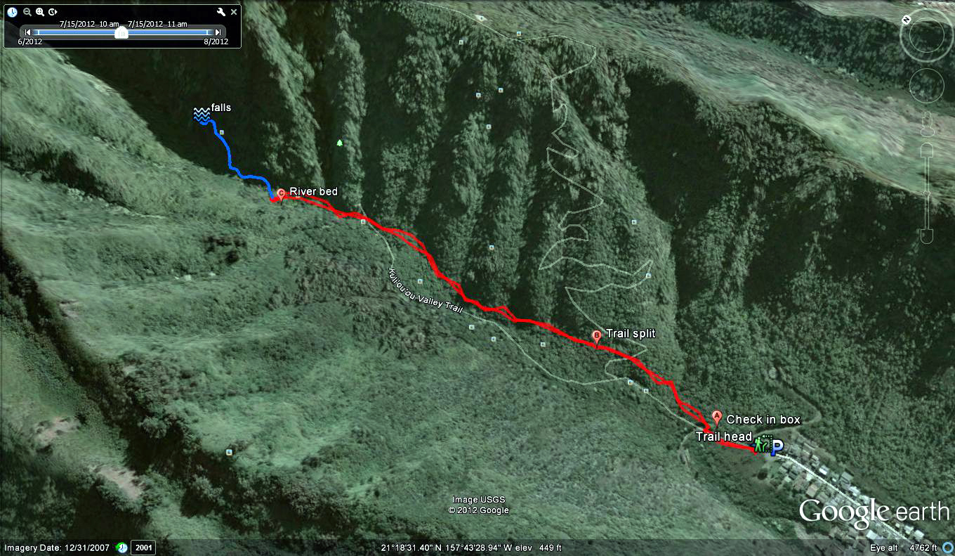
A short and sweet hike with plenty of bliss. Distance: 1.44Mi. Add .66Mi. if you take the falls trail cut off.Elevation: 242ft.-582ft.-242ft.
Time: 46m.-1.5 hours. Add 1 hour if you take the falls trail cut off.
Water consumption: 12oz.
Caloric output: 150-400 calories depending on pace.
Difficulty: 1.8-2.4
Geo Cache: 1
 Way points:
Parking: 21°18'11.77"N 157°43'27.39"W
Trail head: 21°18'12.44"N 157°43'27.59"W
A: Trail and hunter’s check in box. 21°18'15.23"N 157°43'27.85"W
B: Trail split and boot brush. 21°18'23.31"N 157°43'28.07"W
C: River bed. 21°18'44.24"N 157°43'32.78"W
Hidden falls: 21°18'51.49"N 157°43'31.87"W
 Normally I have a bunch of jargon to pepper my hike blogs. For this one, not so much. If you are looking for a short, sweet hike into the woods with little physical impact, this is a great spot.
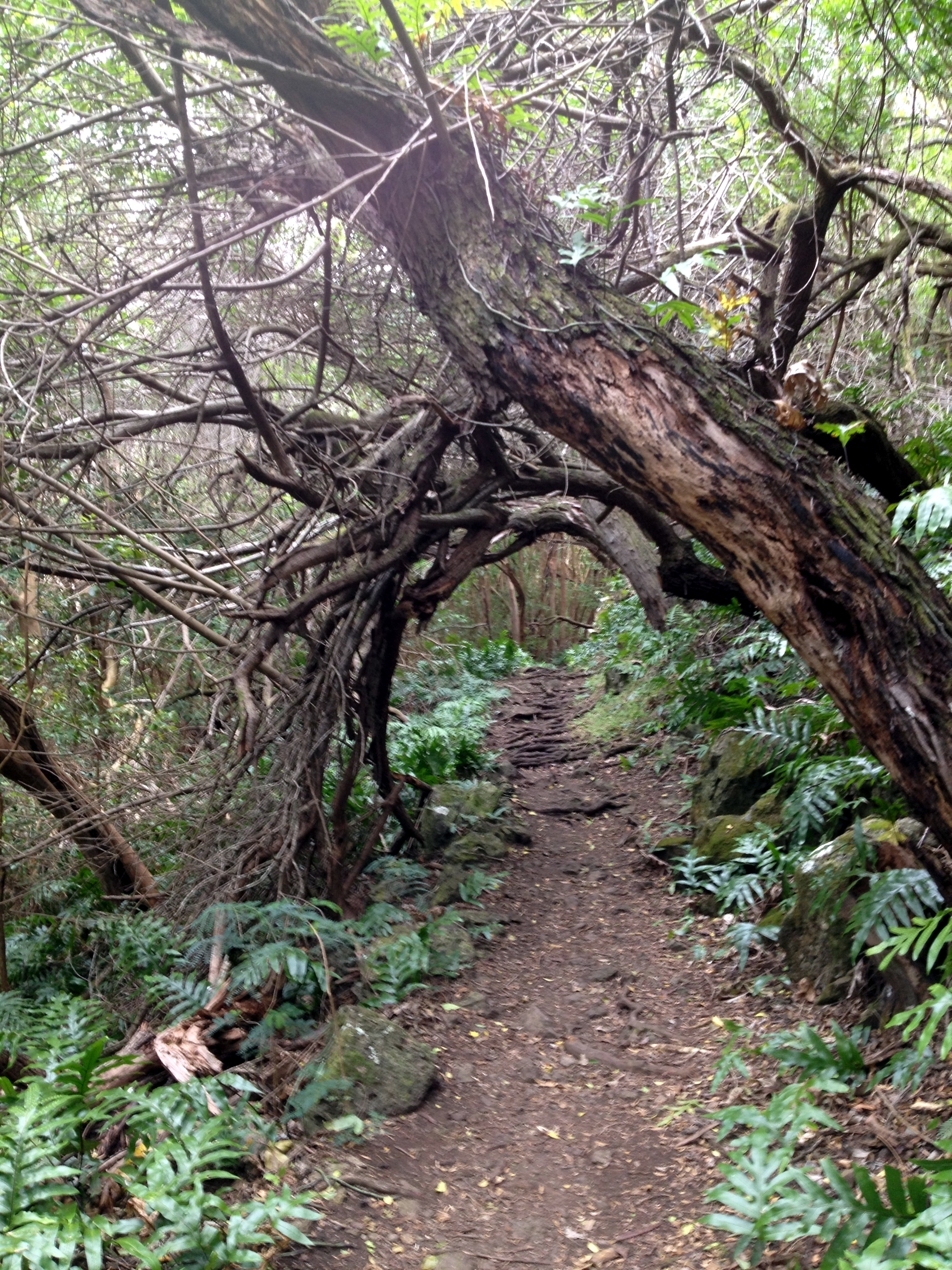
 Don’t get me wrong, the short nature of this hike (and blog) must not detour you from taking a few moments of your weekend or end of day exercise routine. The Kuli’ou’ou Valley Trail Enters a lush exotic forest. I love these types of hikes. I especially like hikes when the trail parallels a stream bed such as this one. Eventually, the trail will lead you to the head of the valley where if you are lucky, you will find a cute little waterfall. When the valley is dry though, only moss will greet you on the cliffs. Still beautiful either way. This is a shaded, pastoral hike with an abundance of moss covered rocks along the way.
The posted trailhead is located at the end of a cul-de sac at the end of Kalaau Pl. Begin your trek at the end of the circle. Walk down the paved road for about 50 yards or so. You will see a footpath that leads up to the right. Also, you will find a clearly marked sign for the trail system. For safety, there has been a hunter’s sign in station mailbox installed. You may want to sign the sheet in the box and tell the world which trail you will be taking. Sounds silly to some, but you never know. Just do it. On your way out, sign out. Simple.
 From here, head north up the trail. In about 0.2 miles, you will find a split in the trail. Your mission is to head straight ahead. (North) The trail up to the right (Northeast) heads up to the Kuli’ou’ou ridge line. I will be mapping this trail and writing about it in the near future. Look around at this point and you will see a set of built-in boot brushes so you can scrape off any noxious weed seeds you may have picked up on your way in. PLEASE try to protect Hawaii’s native vegetation in this area. Take your time and pick off any Kling-on buggers as well. THANK YOU!!!!!
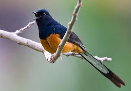
 OK, the trail meets the (usually) dry stream bed in about 0.8 miles. All along the way though, you will be paralleling it. The entire trail is lined with strawberry guava trees and dense ferns. LISTEN!!!! Can you hear them?!?!?!?! Yup, if you are lucky and patient, you are most certain to hear the melodious song of the Shama Thrush. If you are really good, you may even see one. SHHHHHHHHhhhhhhhh...
 After 1 mile of bliss, you will see a couple of tall Cairns that will guide you to the other side of the stream bed. Beyond this point, the trail is not maintained and will become muddy, brushy and at times ridiculously tedious. If you so desire, this rout will take you to the back of the valley where you will end in a beautiful waterfall. Well, at least when it is raining. Otherwise the falls are just a trickle but still worth the adventure. Just knowing hardly any one ventures in this far is satisfaction enough for me. Ahhhhh, alone…..
 OK!!!!! Time for a taco!!!!! Head back the way you came. It should not take you too long. The whole hike is only about 40 min. to 1.5 hours.
 Enjoy and as always, “HAPPY TRAILS YA’LL”!!!!!!
JWM
