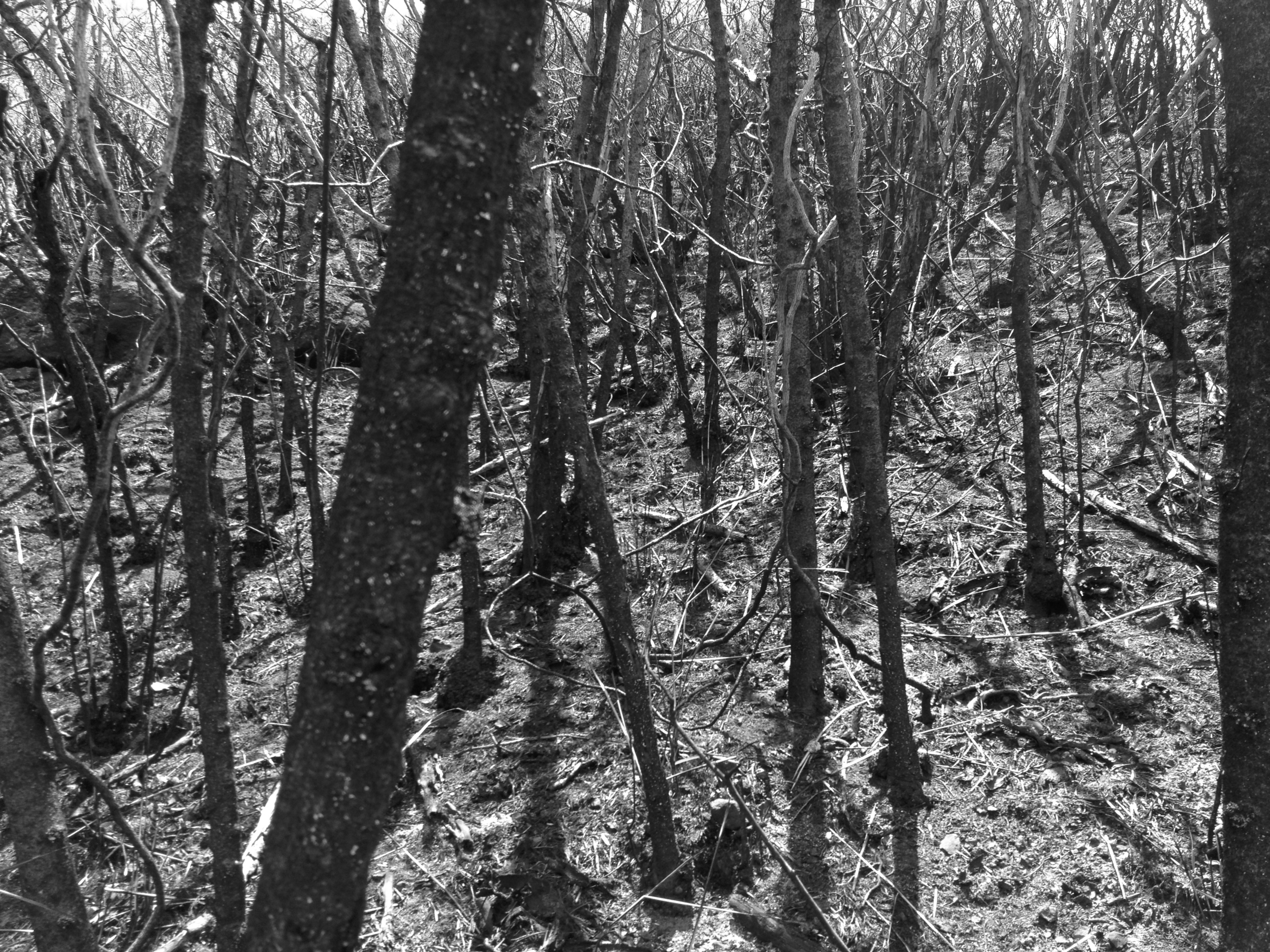
It never ceases to amaze me how Mother Nature ALWAYS takes back what is Her’s. This hike is a perfect example. In fifty years, (since the Pali road was closed) the elements have taken their toll on the road. Plants have started to crowd the old asphalt and concrete, narrowing the path considerably. There are trees that have literally begun to grow through the old cement and concrete. Believe it or not, I noticed several places that the trees were literally holding up parts of the road. I could be wrong about this, but it sure would appear to be the case. Rest assured, I’m sure the trees will do a better job and for longer, than some of the degrading concrete structures I saw.
 Distance: 3.44 Miles
Elevation: 466’-1,208’-466’
Time: 2Hours 10 Minutes
Caloric output: About 1 crispy chicken sandwich and a Jr. Burger.
Liquids: 42Oz.
Distance: 3.44 Miles
Elevation: 466’-1,208’-466’
Time: 2Hours 10 Minutes
Caloric output: About 1 crispy chicken sandwich and a Jr. Burger.
Liquids: 42Oz. Geocache: 3-5
Way points:
Parking: 21°22'22.77"N 157°47'32.32"W
Trail head: 21°22'22.31"N 157°47'30.68"W
Alt. trail head 1: 21°22'25.98"N 157°46'54.46"W
Alt. trail head 2: 21°22'36.22"N 157°47'25.50"W
A: Old Electric station. 21°22'22.61"N 157°47'21.34"W
B: View of the roads above. 21°22'16.61"N 157°47'18.79"W
C: Morgan’s Corner. 21°22'11.56"N 157°47'17.21"W
D: Urban Art. 21°22'11.78"N 157°47'8.95"W
E: Under the bridge. 21°22'10.31"N 157°47'5.98"W
F: Fork, stay right. 21°22'9.11"N 157°47'5.64"W
G: Cut off to falls. 21°22'5.51"N 157°47'16.60"W
Hidden falls: 21°22'1.32"N 157°47'18.06"W
Pali Lookout: 21°22'1.41"N 157°47'35.19"W
I can’t help but to imagine how the trek in an old model “T” would have been like on this route through the Koolau Mountains. The road was often narrow enough already. I get goose pimples just looking at it and contemplating what it must have been like, back in the early 1900s. Puttering up what was sometimes just a narrow one-lane road, with a cliff to your left or right and a hundred-foot drop to your right and left. Unlike more modern roads, the Old Pali Road was built hugging the side of the slope but typically not actually cut into it. In places it’s supported by huge concrete columns. Fantastic it would have been! Especially the downhill sections where wheels locked and ski slope like maneuvers would be normal. Now I can take my mountain bike instead and go wild!!!! Thanks Mother Nature!!!!
 Even though I’ve been to the Pali Lookout like a bazillion times, and traveled the Pali Highway hundreds of times more, I’ve never taken enough time to walk up and down that old road. I had never taken an entire day to just stroll casually along and really notice the changes nature can make to our “HI-TECH” ways. Today, and a few times more this week, I was curious enough to do just that. I hope you will do the same one day!
The road starts out in pretty good shape, considering that it hasn’t been driven on for almost fifty years. But soon enough I found signs that this wasn’t an official road any longer. For one thing, there were rocks on the roadway. Big ones. Like the size of a VW! Some of the masonry was quite old as well. Around Honolulu, I’m used to seeing the occasional WPA-era Bridge, dated 1937 or so, but I thought that a 1919 date was pretty unusual. I wonder who E.J.L. was? You know, all in all, I’m not sure our newfangled “HI-TECH.” roads can compare to this! Especially the bridges. I find them beautiful. Sturdy. Made to last. Real… Let’s go see more!
On the map, I have indicated in blue, some alternative starting points for this trek. As always, in red is the route that I prefer and talk about here. Feel free to explore these other routes and let me know your thoughts! There are days’ worth of exploring to be done out here and a gazillion stories ready to be heard.
“WE GO”!!!!
 I like to start at the Koolau Country Club Golf Paradise and First Pres. Church parking lot. Why? Because my car is safe and there are several other trails that can be accessed from here. The 7 trillion cats that live in the trees are a hoot as well! If you feel so inclined, Honey’s is the restaurant in the clubhouse that can be enjoyed before or after the hike. I feel like I’m a celebrity outdoors man who gets to go back to the club after a day shoot in the amazon jungle. (Like Bear Grill actually sleeps out there and eats grubs for Sunday Brunch) Like “Hey”! Why not! “I’ll have the Eggs Benny and a Mimosa please and would you happen to have a hose to wash the mud off my Alfani’s”?!?!?! “T” Time!!!!!!!!!!
 Just off the parking lot, you will find a break in the bushes. This is where you want to be. There is a set of built in stairs that will aid in your decent on to the old road. From the lot, you will also see a service road up from where you are parked. This is another trail I will write about on another blog. For now, we go the other way. When you get to the old road, head up to the right. You will find yourself on the first wonderful old bridge. It was built in 1919. I would say it looks fantastic for its age and I wouldn’t change a thing about it.
 Up, up, up, you go. The road winds and climbs for several hundred yards from here. There are some great views to be had as well. Not only can you see down through the valley, you can also see way up to the new and old Pali roads, where you will be in about 45 minutes! Don’t believe me? Keep going then!
 Eventually you will come to the famous “Morgan’s Corner”. What is that? Well, for starters, it is where I found a secret stash of avocado trees, that I WILL NOT TELL YOU ABOUT! I HAVE NO IDEA WHAT YOU ARE TALKING ABOUT! WHAT AVACADOS? WHERE? Now for some history…
Morgan’s Corner and Night Marchers:
According to Hawaiian legend, night marchers (huaka‘i po in Hawaiian) are ghosts of ancient warriors. They supposedly roam large sections of the island chain, and can be seen by groups of torches. They can usually be found in areas that were once large battlefields (the Nuuanu Pali on the island of Oahu is a good example.) Legend has it that if you look a night marcher straight in the eye, you will be forced to walk among them for eternity, but if you have a relative taken by them, you will be spared. “Whew”! Hawaiians say that in the presence of night marchers, one should lie down on their stomach, face down to avoid eye contact, stay quiet, breathe shallowly, and don’t move. Some say that they may nudge you to provoke a reaction so they can take you. “JUST CHILL”!!! “THEY WILL PASS”!!! This place I take you is one of the many places the Night Marchers are said to roam.
Carrying pork over the Nuuanu Pali: A big “NO NO”!!!
Local folklore on the island of Oahu says that one should never carry pork over the Pali Highway connecting Honolulu and Windward Oahu. The stories vary, but the classic legend is that if one carries pork of any kind over the old Pali road (not the modern pali highway) by automobile, the automobile would stop at a certain point on the way and not re-start until the pork is removed from the vehicle.
- Some versions of the story require the pork to be raw; other versions say that this happens after dark.
- In some versions, a white dog will appear at the time the automobile stalls, and you must feed the pork to the dog to proceed.
This legend has its roots in ancient Hawaiian mythology. According to legend, the Hawaiian volcano goddess Pele and the demigod Kamapua‘a (a half-man-half-pig) had a turbulent relationship, and the two agreed not to visit each other. If one takes pork over the Pali, the legend goes, one is symbolically taking a piece of Kamapua‘a from one side to the other, and it is said that Pele would stop that from happening. I can’t help but to wonder if it is OK to bring in a side of pork from Franklin’s in Austin Texas. Would I have to drive it around the Waimanalo side of the island from the airport? This would avoid the more direct rout over the Ko’olaus and the Pali. Hmmmm… There is no way I would share that pristine BBQ with any “White Ghost Dog” just to pass! Perhaps I could throw the white dog a can of Spam? I keep a few in my trunk to bribe the Menahune when I camp in Ho’omaluhea. Keeps them out of my Tacos. :)
Modern urban legends: The “REAL” scary stuff…
Morgan's Corner refers to two places on Oahu; one on the Nuuanu Pali Drive leading into Nuuanu valley above downtown Honolulu, and one in Windward Oahu below the Nuuanu Pali. It is said that the apparent spirit that haunts these places are in reference to the murder of Therese Wilder, whose residence was located on the Nuuanu Pali road in 1948. However, both of these places are connected to urban legends. Hmmm…
 The story states that a girl named Brittani Lochmann from the Morgan's residence hanged herself on the tree at the end of the road. Ouch. She was lost for a couple of days and by the time she was found, her head had severed itself from her body, leaving her head hanging by the rope alone. Her head and her body were never re-attached at burial, leaving her to forever roam the Nuuanu Pali Drive. It is said that fireballs can be seen behind boulders here, and it is also said that if you sit under the tree and look up you will see a girl hanging from the branches. I have heard reports of small balls of orange light, reminiscent of torches in the distance that can be seen as well. Almost as though they were always approaching you only to vanish in an instant and re appear again at a distance. Last time I was here during the day, I sat on the wall of the bridge for a rest and some water. I would testify before a court that I heard a small girl crying just below my feet. I looked about the bridge and beneath and saw nothing. I have to admit that the sound was so convincing, I even resorted to calling out for a response from the child. My advice is just to move on and say a prayer for who it is that resides here. Legend also has it, if you're in a car you would see a big black figure sitting on the tree above you. Although the road is closed to cars now you can hike or ride a bike up the trail leading to the residence. This WILL be on my list of hikes to revisit at night!!! Any takers?!?!?
OK, back to the trail. One day I was greeted by a group of Power line workers who use Morgan’s Corner as a landing spot for their helicopter while taking a sandwich break. What a job! These guys have the life! I may quit my job and do this for a while. Cool stuff. At any rate, when you are at the “Corner”, don’t head down to the left fork. It will take you down to the new Pali Hi way. You can explore this rout another time. Instead, head up the road in front of you. Up, you go!
 It is in this section you will begin to see how Mother Nature has taken her grasp on the old road. The trail narrows from time to time, yet you will notice there is actually old concrete under those rocks and dirt clods. Cool! Just keep on going around the bends and dips. Eventually you will come to some signs of old urban hieroglyphs! Yup. It turns out you are just about to venture below the new Pali Hi Way where plenty of urban artists have left their mark. I like to think of it as ancient records of a long past civilization sprawled out to be read by all for eternity. All be it these glyphs are modern in reality, they are now part of Hawaii’s history. Enjoy the art!!!


 When you find yourself at a small pass through under the new Pali road, head under the structure to the other side. You will hear the cars passing over your head and it can be a bit nerve racking. No problem though! There will be an old set of stairs and latter that awaits your escape on the other side. Please take care here. The wooden structure is old and fragile, so take care in your steps.
 On the other side, you will come to yet another fork in the trail. Your aim is to head up to the right. This way you will be looking down onto the Hi Way and some fabulous views! Up, up, up you go!
 In and out the road winds over passes and streams. You will also see where Mother Nature has really begun her work. Trees growing through the road and fallen rocks and mud slides that have eaten much of the cement. Take your time here and enjoy the rebirth of nature. Views of the tunnels are here as well. If you look up, you will see several valleys where waterfalls scrape away at the mountain. There are trails up many of these valleys and I will mark a few for you on the map above. Others, you will need to take the time to explore on your own.
In several places along the way, one can see clusters of holes in the rocks, each about as big around as your thumb. Some think they were the remnants of blasting holes drilled during the road construction back in the 1890s. Road workers would have drilled long deep holes into the rock, packed sticks of dynamite into them, and blasted the rock away. “BOOOOM”! What we see today are the ends of the holes, left over after blasting. Personally, I like to think of these as ancient alien worm holes. You see, there is a legend originally found in the Anunnaki texts, which talk of rock worms. They travel the earth by tunneling rather than by ground. Some were the size of a pencil, others the size of a city bus and bigger! Although the “Worms” may have been extinct for over a million years, there holes can sometimes reappear during earth moving operations such as the ones necessary to build this Old Pali Road. Completely plausible as far as I am concerned.
 YOU MADE IT! The Pali Lookout!
 When you are at the Pali Lookout you can see the old road going down the mountain to the right. It’s a great place for walking/hiking with the family and has great views and nice breezes. When I say breezes, I mean wicked winds! This place can easily lift a few skirts and then some! Woooo Hooooo! Fun stuff!!!! This is the Windward section of the Old Pali Road, which was replaced in 1959 by the Pali Highway. I enjoy this spot for an easy afternoon hike and my favorite way to do it is obviously from the bottom up. If you’re feeling adventurous, there are some further trails that will take you to some wicked awesome places. I may write about them in a future post, but be aware that these are trails for the experienced trekkers ONLY! Just look up to either side and you will see what I mean.
Some More History:
 The Pali Lookout. Oh boy. Allow me to put this in a nut shell for ya. Well, it was here that in 1795 King Kamehameha and his warriors (which consisted of a fleet of 10,000 soldiers and 960 war canoes) defeated the warriors from Oahu and its then ruler, King Kalanikupule. In doing so, Kamehameha The Great, united the Hawaiian Islands and became its first unified King. As you stand and stare out towards Kaneohe Bay, know that over 400 men were forced off the Pali’s cliff, a drop of 1,000 feet. Yes, that happened at the Pali Lookout. Now, as legend would have it, the winds that day were incredibly fierce through the valley. So fierce indeed that some of the worriers actually were blown back up the cliffs to the top, before splattering on the bottom. “Weird and wild stuff”… I can believe it. Just last week, the winds yanked the sunglasses rite off my face and sent me all willy nilly! Try eating a taco up here! SAUCE EVYWHERE!!!!! AHHHHH!!!!!
 OK, boys and girls. My post is over and so is this hike. When you’re ready to head out, just head on back the way you came in. Pretty simple. If you had thought ahead, you would have a warm and comfy car waiting for you in the parking lot up top. HA HA! See ya at the bottom!
Happy trails ya’ll!!!
PS: Don’t let those urban legends deter you from making this hike. It is a wonderful and magical place for sure… With hidden avocado trees!!!!!!!
JWM


 Trail head 1: 21°18'2.22"N 157°41'34.28"W
Trail head 2: 21°17'54.19"N 157°41'24.39"W
A: Kaiwi Road: 21°18'5.49"N 157°41'34.53"W
B: Urban dump: 21°18'31.15"N 157°41'34.36"W
C: Water ruts: 21°18'46.13"N 157°41'35.38"W
D: Jeep road: 21°18'48.91"N 157°41'31.31"W
E: Pine trees: 21°18'59.45"N 157°41'32.96"W
F: Big rock: 21°19'2.05"N 157°41'32.01"W
G: Thick: 21°19'5.94"N 157°41'32.95"W
H: Thicker: 21°19'11.79"N 157°41'34.88"W
I: Slab: 21°19'13.41"N 157°41'36.32"W
J: Ridge: 21°19'15.03"N 157°41'35.62"W
K: Pine forest: 21°19'13.59"N 157°41'23.70"W
L: Trail cut-off: 21°19'15.07"N 157°41'19.54"W
M: Drink: 21°18'51.61"N 157°41'14.70"W
N: View: 21°18'36.46"N 157°41'18.05"W
O: Cut-off: 21°17'58.21"N 157°41'23.22"W
P: Heiau: 21°17'54.70"N 157°41'23.51"W
Trail head 1: 21°18'2.22"N 157°41'34.28"W
Trail head 2: 21°17'54.19"N 157°41'24.39"W
A: Kaiwi Road: 21°18'5.49"N 157°41'34.53"W
B: Urban dump: 21°18'31.15"N 157°41'34.36"W
C: Water ruts: 21°18'46.13"N 157°41'35.38"W
D: Jeep road: 21°18'48.91"N 157°41'31.31"W
E: Pine trees: 21°18'59.45"N 157°41'32.96"W
F: Big rock: 21°19'2.05"N 157°41'32.01"W
G: Thick: 21°19'5.94"N 157°41'32.95"W
H: Thicker: 21°19'11.79"N 157°41'34.88"W
I: Slab: 21°19'13.41"N 157°41'36.32"W
J: Ridge: 21°19'15.03"N 157°41'35.62"W
K: Pine forest: 21°19'13.59"N 157°41'23.70"W
L: Trail cut-off: 21°19'15.07"N 157°41'19.54"W
M: Drink: 21°18'51.61"N 157°41'14.70"W
N: View: 21°18'36.46"N 157°41'18.05"W
O: Cut-off: 21°17'58.21"N 157°41'23.22"W
P: Heiau: 21°17'54.70"N 157°41'23.51"W Kamiloiki is a pretty groovy ridge hike in East Oahu. You can get to the trail from the Pahua Heiau, just off Makahuena Place in Hawaii Kai, and ascends to the Koolau summit overlooking Waimanalo at an elevation of about 1,400 feet. Not on this day. If you are out of your mind like my friend and I, you can ascend to the ridge from the valley. Apparently there used to be a few old Jeep roads and trails that would lead to the back of this valley, ultimately ending at the saddle of the ridge. In the 1960’s, there was some quarry work going on back in this valley and some of the old roads can be made out in Google Earth. That means absolutely nothing while buried in 18 foot tall grass. Ever tried to navigate a corn field? Then you get what I’m saying. The entire route was grown over and all maps had little relevance to what I mapped on my GPS units. So, what I did was hack through the bushes and drop bread crumbs all along the way for you to fallow. Although there was evidence of a trail, from time to time those little pink hike markers quickly disappeared and we found ourselves bush-whacking our way to the top. If you find yourself discouraged, take a breath and look for the ridge in the distance. Just head there. I assure you, it is possible, so be cool and stay frosty. “DID HE SAY BEE”????? “RUN”!!!
 This is an old service road that heads for quite a distance into the valley. You may see some urban remnants and some additional trails on the left and right, but just stay on the main road until it peaters out. When this is the case, just keep a sharp eye out for those pink and orange trail markers. They will lead you into the fire for sure, but have faith my fellow hikers. “BE THE TRAIL GRASS HOPPER”!
 Along the way and after a few scrapes, you will find your way across many water ravines and old grown over roads. In such cases, it is easy to have the desire to follow those roads into hell, but DO NOT stray from the markers yet. Even if they lead you into a wall of grasses, you must stay the course at all costs. Some of these other routes may lead you back the wrong direction and that would be a waste of time for sure. Our goal is up, up, up!!!

 Soon enough, you will be able to make out the trail along the saddle ridge before you. The last few steep spots will tax you, but never fear for the view just over there is worth it. Something to remember as well, by now you are as hot a flap-jack on a griddle. If you make it to the ridge, it has breezes that would cool even the hottest Supermodel down to her bones! (Oh boy) ”Got water”?!?!
  YOU MADE IT!!!! Now look left and right! Look ahead! This is some awesome stuff guys’! The ridge trail on the right follows an open ridge with little shade, although it enters an ironwood forest just before the final climb to the summit. The cliffs below will steepen a tremendous amount below you as you climb the exposed rocks. Never fear though, the trail has been well traveled and feels safe. The 5-mile round trip is okay for older children, providing they are under complete control at the summit at all times. At the end of the trail, a cliff appears suddenly, and drops precipitously more than 1,000 feet. This is no place for kids to be running around, and the acrophobic will want to hang back in the wooded area behind the drop-off.